Environmental protection and resource management increasingly depend on accurate, timely, and large-scale data collection. Traditional monitoring methods often face challenges such as limited coverage, delayed information updates, and difficulties accessing complex environments. With the development of low-altitude unmanned aerial vehicle (UAV) technologies, organizations are adopting smarter approaches to observe ecosystems, analyze environmental changes, and improve decision-making.
A modern environmental monitoring platform combines drone perception, spatial intelligence, three-dimensional modeling, and artificial intelligence to create a more comprehensive understanding of natural and urban environments. These solutions enable governments, enterprises, and environmental organizations to collect real-time information, identify risks, and manage resources more efficiently. By integrating aerial data with digital platforms, low-altitude UAV systems are becoming an important foundation for next-generation ecological management.
The Role of UAV Technology in Modern Environmental Monitoring
Environmental monitoring involves the continuous observation of natural resources, landscapes, weather-related changes, and human activities that may affect ecosystems. Conventional approaches often rely on ground surveys, satellite imagery, or manual inspections. While these methods remain valuable, they may not provide the flexibility and responsiveness required for complex monitoring scenarios.
A UAV-based environmental monitoring platform improves data acquisition by providing flexible aerial coverage and high-resolution information. Drones can provide aerial observation of forests, wetlands, rivers, agricultural areas, and urban environments while reducing the need for some labor-intensive field operations. The collected imagery and sensor data can support environmental assessment, pollution detection, vegetation analysis, and emergency response.
For organizations responsible for ecological protection, a digital approach also creates opportunities for predictive management. Instead of responding only after environmental problems occur, operators can analyze trends and identify potential risks earlier through continuous data collection.
Building an Ecological Monitoring System Through Spatial Intelligence
An effective ecological monitoring system requires more than drone flights and image collection. The real value comes from integrating multiple data sources into a unified intelligence framework. Remote sensing imagery, three-dimensional models, and airspace information must work together to create a complete understanding of environmental conditions.
This company develops spatial intelligence solutions by combining 3D technologies, artificial intelligence, and low-altitude data capabilities. The company builds a digital foundation for the low-altitude economy through full-domain drone situational awareness, intelligent planning, and safety control technologies.
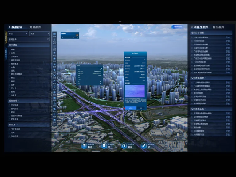
The platform integrates three core capabilities: real-scene 3D, air-ground integration, and intelligent connectivity. Together, these capabilities provide organizations with scalable tools for managing low-altitude operations while supporting environmental observation and other commercial applications.
A Digital Foundation for Comprehensive Low-Altitude Environmental Applications
Large-scale ecological management requires a structured data framework that can support different operational scenarios. Icecypress Technology applies a “1 Foundation + 1 Platform + N Scenarios” architecture to create a comprehensive governance model for the low-altitude economy.
The foundation is built on a spatial data system that integrates multiple information sources, including remote sensing images, real-world 3D models, and airspace data. This creates a detailed digital representation of geographic environments and provides the necessary data foundation for intelligent analysis.
The platform layer focuses on data fusion, 3D analysis and rendering, and scenario construction. Through these capabilities, organizations can develop customized applications for environmental management, emergency response, urban governance, agricultural monitoring, and other fields.
This approach allows an ecological monitoring system to move beyond isolated data collection. Instead, it creates a connected environment where information can be analyzed, visualized, and applied to practical decisions.
Intelligent Airspace Management Supports Sustainable UAV Operations
As UAV applications expand, managing low-altitude airspace becomes increasingly important. A safe and efficient aerial environment requires more than simple maps. Operators need accurate information about flight corridors, restricted areas, landing locations, and potential risks.
Icecypress Technology transforms airspace data into a structured and manageable resource. Instead of treating airspace information as static map layers, the platform manages airspace designations, routes, landing sites, and risk zones as full-lifecycle digital objects.
This capability helps organizations improve operational efficiency through intelligent route planning, terrain analysis, and spatial traffic prediction. The platform can support more efficient airspace coordination while helping operators maintain compliance with safety requirements. Faster route approval and emergency access planning also help organizations respond quickly to urgent situations.
For environmental applications, intelligent airspace management enables more reliable drone operations across large regions, supporting continuous monitoring of ecosystems and remote areas.
Supporting Diverse Environmental and Commercial Scenarios
The flexibility of a modern environmental monitoring platform allows it to serve multiple industries and public applications. Environmental agencies can use UAV data to monitor protected areas, evaluate ecological changes, and support conservation programs. Agricultural organizations can apply aerial intelligence for crop management and plant protection.
Beyond environmental applications, the same low-altitude infrastructure can support emergency rescue, logistics, cultural tourism, and smart city management. This multi-scenario capability reduces technology deployment costs and allows different industries to share the same digital foundation.
By connecting drone operations, spatial data, and intelligent analysis, organizations can achieve more efficient resource utilization while developing new opportunities within the low-altitude economy.
Advancing Environmental Intelligence Through Low-Altitude Innovation
The future of environmental management can benefit from technologies that provide accurate information, faster analysis, and smarter decision support. Low-altitude UAV platforms are helping organizations address some limitations of traditional monitoring methods by combining aerial perception with digital intelligence.
Icecypress Technology provides a comprehensive approach to low-altitude operations by integrating 3D visualization, air-ground coordination, and intelligent connectivity. Its solutions support the development of a more connected and data-driven ecological monitoring system, enabling organizations to manage environmental resources with greater precision.
As cities and industries continue adopting low-altitude technologies, intelligent monitoring platforms will play an increasingly important role in creating sustainable, efficient, and safer environments. By transforming aerial data into actionable insights, these solutions are helping shape the future of environmental protection and smart management.
